
Mexico's Regions as Travel Destinations: More Than One Country in One
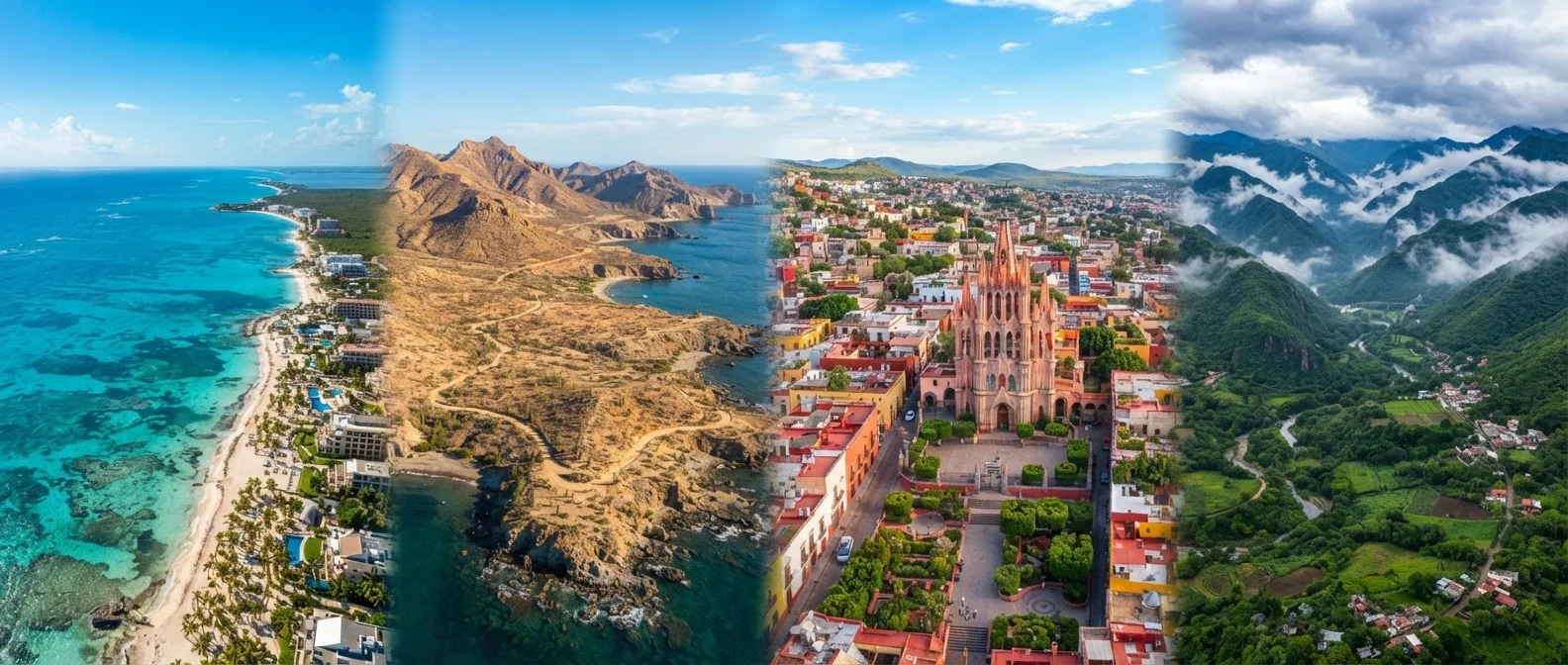
Photo credit: ArticlesHaven.net
In this article
The Yucatán, Baja, Mexico City, and Oaxaca are vastly different experiences. Compare Mexico's major travel regions by vibe, cost, and accessibility.
Why Mexico's Regions Demand Different Trip Plans
Mexico is often treated as a single destination, but the country spans roughly 760,000 square miles and contains a dozen distinct climate zones. The Yucatán Peninsula, Baja California, Mexico City, and Oaxaca aren't just different stops - they represent genuinely different travel experiences in terms of infrastructure, food culture, cost, weather, and pace. Travelers who treat them as interchangeable often end up in the wrong place for their expectations.
This overview breaks down Mexico's major travel regions by what they actually deliver, so you can match your budget, travel style, and timing to the right destination. For a useful contrast with regional travel closer to home, see how the American Southwest divides into distinct zones.
| Mexico's total area | Approx. 761,600 sq miles (INEGI (Mexico's national statistics agency)) |
| Mexico City elevation | ~7,350 feet above sea level |
| Yucatán hurricane season | June-October (NOAA Atlantic hurricane season data) |
| Length of Baja Peninsula | ~775 miles |
| Oaxaca's primary airport | Xoxocotlán International (OAX) |
| UNESCO World Heritage Sites in Mexico | 35 (as of recent UNESCO records) (UNESCO World Heritage List) |
The Yucatán Peninsula: Ruins, Reefs, and Resort Tiers
The Yucatán is Mexico's most heavily touristed region, anchored by Cancún and the Riviera Maya corridor. It offers reliable infrastructure - direct US flights, English-speaking staff, and all-inclusive resorts - which makes it the lowest-friction entry point for first-time visitors or families.
But there's meaningful variation within the region. Cancún's hotel zone is built for volume tourism. Playa del Carmen skews younger and more walkable. Tulum is marketing itself as a luxury eco-destination, though prices have climbed sharply. Further inland, Mérida is one of Mexico's most livable colonial cities - dramatically cheaper and culturally richer than the coast, with proximity to Chichén Itzá and the Puuc archaeological sites.
The Caribbean coast is best visited from November through April, avoiding the June-October hurricane window. Cenotes (freshwater sinkholes) are a unique regional draw, but the best-known ones now see high daily visitor counts - early arrival or booking lesser-known alternatives is worth considering.
35M+
International tourists to Mexico annually
Mexico consistently ranks among the world's top 10 most-visited countries, according to UNWTO tourism data.
~40%
Share of visitors arriving via Cancún airport
Cancún International handles a disproportionate share of Mexico's inbound international air traffic, reflecting the Yucatán's dominance in resort tourism.
21M+
Population of the Mexico City metro area
Mexico City is one of the largest urban agglomerations in the Western Hemisphere, per Mexico's national census data.
Baja California: Desert Coast with a Different Pace
Baja is one of the longest peninsulas in the world, stretching roughly 775 miles from Tijuana to Cabo San Lucas. It sits in a Pacific time zone, has a desert climate, and feels geographically removed from the rest of Mexico. This matters logistically: the peninsula is accessible by road from California and Arizona, making it a popular drive-in destination for US West Coast travelers.
Los Cabos (the Cabo San Lucas and San José del Cabo area) caters to resort-style visitors, with higher price points comparable to the Riviera Maya. La Paz, further north on the Sea of Cortez, has a slower, more local feel with outstanding marine wildlife - whale sharks, sea lions, and mobula rays are seasonal draws. The Baja 1000 off-road racing corridor and wine country near Valle de Guadalupe add a different dimension for adventure and food-focused travelers.
Climate is one of Baja's genuine advantages: the desert setting means more consistent sunshine year-round than the hurricane-prone Caribbean coast, though summer temperatures in the interior can be extreme.
Mexico City and Oaxaca: Urban and Cultural Depth
Mexico City is one of the largest metropolitan areas in the world and one of Latin America's most culturally dense. World-class museums, a thriving restaurant scene, historic architecture, and a walkable neighborhoods structure make it a compelling urban destination. It's also notably affordable by major-city standards - dining and public transit costs are low compared to US cities of equivalent stature.
Altitude is a practical consideration: Mexico City sits at roughly 7,350 feet, and some visitors experience mild altitude adjustment in the first day or two. For those planning a multi-city trip, see how to weigh single-destination versus multi-city itineraries before building an itinerary that combines the capital with coastal areas.
Oaxaca, about 5 hours south by air or road, punches well above its size in cultural weight. It's a center for Indigenous textiles, pre-Columbian ruins (Monte Albán), mezcal production, and a food scene that draws serious culinary travelers. Cost of living and travel expenses in Oaxaca are among the lowest of any major Mexican tourism destination.
Cenote
A natural sinkhole filled with fresh groundwater, formed when limestone bedrock collapses. Cenotes are common throughout the Yucatán Peninsula and are popular for swimming and snorkeling.
Riviera Maya
A stretch of Caribbean coastline in the Yucatán state of Quintana Roo, running roughly from Cancún south to Tulum. It contains the highest concentration of resort hotels and tourist infrastructure in Mexico.
Mezcal
A distilled spirit made from agave plants, produced primarily in the state of Oaxaca. Distinct from tequila, which is a specific type of mezcal made only from blue agave in Jalisco and a few other states.
All-Inclusive Resort
A hotel model where the room rate covers meals, drinks, and most on-site activities. Common in the Yucatán and Los Cabos; useful for budget predictability but limits exposure to local food culture.
Altitude Sickness
A temporary condition caused by reduced oxygen at high elevations, sometimes experienced by travelers arriving in Mexico City. Symptoms typically include mild headache, fatigue, or nausea and usually resolve within a day or two.
Comparing Regions: Cost, Season, and Travel Style
No single region is objectively best - the right fit depends on what you're optimizing for. The table below summarizes how Mexico's main regions compare across key travel factors.
| Region | Relative Cost | Best Season | Travel Style Fit |
|---|---|---|---|
| Yucatán Coast | Mid-High | Nov-Apr | Beach, resort, archaeology |
| Baja California | Mid-High (Cabo); Low-Mid (La Paz) | Year-round (avoid peak summer heat inland) | Adventure, marine, drive trips |
| Mexico City | Low-Mid | Oct-May | Urban, cultural, food |
| Oaxaca | Low | Oct-Jun | Cultural, culinary, artisan |
If you're weighing Mexico against other international destinations, South America's regional variation offers a useful parallel - the same logic of treating a country as a collection of distinct sub-destinations applies. Similarly, the coastal vs. inland decision framework can help clarify whether Oaxaca or the Riviera Maya makes more sense for your trip style.
Safety Conditions Vary Significantly by Region
Mexico's overall travel advisory picture is not uniform. Some regions and corridors have elevated risk advisories from the US State Department, while others - including many popular tourist zones - have lower-risk designations. Conditions can shift. Check the State Department's Mexico travel advisory page and your destination's specific state-level rating before booking or traveling.
Travel conditions, entry requirements, and regional safety advisories can change. Always verify current guidance through official government travel advisories and consult your airline or tour operator before booking.

Author
Articles Haven Editorial Contributor
Articles Haven Editorial Team is the collective byline for our editorial team and contributor network. Articles published under this byline or an editorial pen name are researched, written, and reviewed according to our editorial standards for clarity, consistency, and independence before publication.
View all articles →